Geography
Cody is located at 44°31′24″N 109°3′26″W / 44.52333°N 109.05722°W (44.523244, -109.057109).[4]
 |
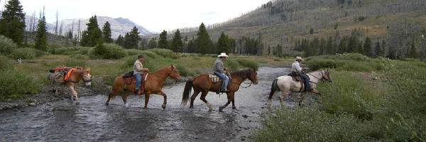
| Near Cody, Wyoming |
Cody's elevation is about 5016 ft (1,500 m) above sea level. The main part of the city is split across three levels, separated by about 60 feet (18 m).
The Shoshone River flows through Cody in a fairly deep canyon. There are four bridges over this river in the Cody vicinity, one at the north edge of town that allows travel to the north, and one about 5 miles (8 km) east of Cody that allows passage to Powell, and the areas to the north and east. The other two are west of town; one allows access to the East Gate of Yellowstone National Park, and the other is used by fishermen in Shoshone Canyon and as access to the Buffalo Bill Dam.
 Cody is located at the western edge of the Bighorn Basin, a depression surrounded by the Big Horn, Owl Creek, Bridger, and Absaroka ranges. At the western edge of Cody, a deep canyon formed by the Shoshone River provides the only passage to Yellowstone's Eastern Entrance. At its mouth and rising above Cody are Rattlesnake Mountain on the north side and Cedar Mountain on the south side. Most of Cody has a spectacular view of Heart Mountain, whose 8000 ft (2,400 m) peak is 9 miles (14 km) directly north of Cody, and the Carter Mountains, which form a line with peaks at about 12,000 ft (3,700 m), some 15 miles (24 km) to the south.
 |
"The Scout" by Gertrude Vanderbilt Whitney commemorates Buffalo Bill |
Culture
Themes surrounding Cody's pioneer and Cowboy and Western history are common in the cultural events and activities in the area.
The Buffalo Bill Historical Center is a large and modern facility located near the center of the city. It contains five museums in one, and maintains large collections. It is a favorite stopping point for tourists passing through the town, on their way to or from Yellowstone. During the summer, a re-enactment of a wild-west shoot-out takes place next to the Irma Hotel, another historical site still open for business with a hotel and restaurant, which forms the nucleus of the town.
Old Trail Town in Cody, Wyoming.
 |
| The flag waves at the start of the Cody Nite Rodeo, August 6, 2006 |
Rodeo is important in the culture in Cody, which calls itself the "Rodeo Capital of the World". The Cody Nite Rodeo is an amateur rodeo every night from June 1 through August 31.
 |
| Cody Rodeo |
The Cody Firearms Museum has a large collection of American firearms.
Cody is the birthplace of the famous abstract artist Jackson Pollock.
Education
Public education in the city of Cody is provided by Park County School District #6. Three elementary schools – Eastside, Glenn Livingston, and Sunset - serve students in grades kindergarten through five. The district's two secondary campuses are Cody Middle School (grades 6-8) and Cody High School (grades 9-12).Industry
The primary industry in Cody is tourism. Hotels, restaurants and shops cater to travelers coming to visit the West and Yellowstone Park. Cody has several art galleries, with some notable local painters and artists living in the area. Another industry is western style furniture, with several small furniture makers producing custom pieces. The oil industry seems to wax and wane over the years in the Cody area. Just to the south of Cody are large deposits of gypsum. Park County School District #6 is another large employer in the area.Climate
The weather in the Big Horns is highly variable, with large temperature swings always possible. Winters normally bring average lows of 10 °F (-12 °C), and summers can bring record highs of 100 °F (38 °C). Relative humidity is usually a fairly dry 30% or less. Precipitation averages 9 inches (229 mm) of rain per year, making the surrounding area a semi-arid desert. During June, July, and August, if it does snow, it is usually brief and melts quickly. Such events are not frequent, but there are sudden and drastic shifts in weather conditions. Cody enjoys about 300 days of sunshine per year.Wind is almost a constant presence in the Cody area and the Big Horn Basin in general. Air flow in the Basin is turbulent, but during the winter most storms move in from the north-northwest. During the summer it is not unusual to see storms move in from the southwest. Throughout a normal day, winds can be experienced as coming from almost any direction, mostly from the north and west, but sometimes from the south and east. The Canyon at the west end of Cody funnels rain and wind across the city from the west. The winds can be quite strong at 30 to 40 mph (50 to 60 km/h) and last for several days.
Because of the dry climate, the entire area is laced with irrigation canals, holding ponds, laterals, and drops. The Buffalo Bill Dam between Rattlesnake and Cedar mountains forms a large reservoir about 10 miles (16 km) to the west of Cody. This reservoir (among others) feeds the Shoshone Project, a large irrigation water distribution system.
In January the average maximum daily temperature is 35.9 °F (2.2 °C) and the minimum is 12.8 °F (−10.7 °C). In July the average maximum temperature is 84.9 °F (29.4 °C) and the minimum is 54.6 °F (12.6 °C). An average of 18.0 days have highs of 90 °F (32 °C) or higher and an average of 168.4 days have lows of 32 °F (0 °C) or lower. The record high temperature was 105 °F (41 °C) on July 14, 1925, and the record low temperature was −46 °F (−43 °C) on February 8, 1936.
The wettest year was 1991 with 16.04 inches and the dryest year was 1956 with 3.58 inches. The most rainfall in one month was 5.76 inches in June 1992. The most rainfall in 24 hours was 2.51 inches on July 22, 1973. There are an average of 68 days with measurable precipitation. Annual snowfall averages 39.7 inches. The most snow in one year was 70.7 inches in 2000. The most snow in one month was 26.3 inches in January 1972.[5]
Demographics
| Historical populations | |||
|---|---|---|---|
| Census | Pop. | %± | |
| 1910 | 1,132 | ||
| 1920 | 1,242 | 9.7% | |
| 1930 | 1,800 | 44.9% | |
| 1940 | 2,536 | 40.9% | |
| 1950 | 3,872 | 52.7% | |
| 1960 | 4,838 | 24.9% | |
| 1970 | 5,161 | 6.7% | |
| 1980 | 6,599 | 27.9% | |
| 1990 | 7,897 | 19.7% | |
| 2000 | 8,835 | 11.9% | |
| [6] | |||
There were 3,791 households out of which 29.0% had children under the age of 18 living with them, 50.7% were married couples living together, 9.5% had a female householder with no husband present, and 36.6% were non-families. 32.2% of all households were made up of individuals and 12.4% had someone living alone who was 65 years of age or older. The average household size was 2.27 and the average family size was 2.86.
In the city the population was spread out with 24.8% under the age of 18, 7.2% from 18 to 24, 26.4% from 25 to 44, 24.9% from 45 to 64, and 16.6% who were 65 years of age or older. The median age was 40 years. For every 100 females there were 90.9 males. For every 100 females age 18 and over, there were 88.1 males.
The median income for a household in the city was $34,450, and the median income for a family was $40,554. Males had a median income of $31,395 versus $19,947 for females. The per capita income for the city was $17,813. About 9.4% of families and 13.9% of the population were below the poverty line, including 19.3% of those under age 18 and 11.0% of those age 65 or over.
No comments:
Post a Comment